

I have added a map of biblical and Talmudic places to Bekiut. The current initial version includes 34 places, from Jerusalem and Tiberias to Alexandria, Rome, and several Jewish centers in Babylonia. Selecting a name or a marker opens a short identification, the source for its coordinates, and notes about uncertainty.
I wanted a way to look up a place while reading and see its approximate position relative to other places, as a selected representative reference list.
The starting material was two place-name lists from my Talmud NLP Indexer repository: a gazetteer with 38 lines of biblical places mentioned in the Talmud, and a gazetteer of non-biblical places in the Talmud with 659. Bekiut already uses these lists for highlighting names in texts; extending them into a map required additional decisions about which names refer to the same place, which modern location to use, and how confidently to display a marker.
Screenshots:
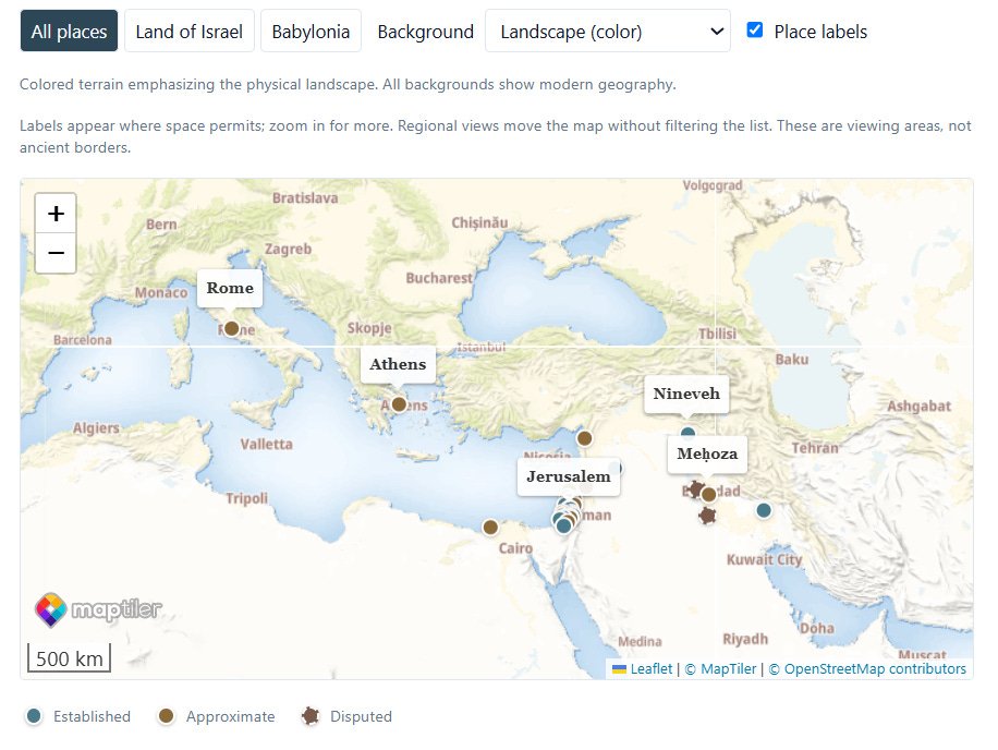
Map:
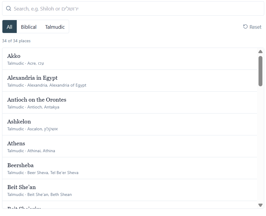
List:
From names to locations
The source lists contain names and spelling variants, without coordinates. For this initial version, I selected places with usable modern identifications and recorded a coordinate source for each. The coordinates come from the cited Wikipedia articles, supplemented in some cases by separate historical references.
Among the 34 records, six have biblical-list membership and 30 have Talmudic-list membership; two belong to both.
What a marker means
I use three labels: “Established,” “Approximate,” and “Disputed.” For example, for Jericho, I use the point for Tell es-Sultan rather than the center of modern Jericho. For Shechem, the marker identifies Tell Balata rather than the center of Nablus. Rome and Athens have approximate city reference points.
Some names require an explicit choice between different places. The map selects Alexandria in Egypt, Caesarea Maritima, and Antioch on the Orontes.
The Babylonian centers required more caution. Sura, Pumbedita, and Nehardea have disputed markers with notes explaining the proposed locations. Meḥoza has an approximate identification with Veh-Ardashir.
For Nehardea, the notes record conflicting coordinates in the reference material. For Pumbedita, the marker is a reference point for the proposed vicinity of modern Fallujah.
Reading the map
The page combines a searchable list with an interactive map; selecting either a list item or a marker brings up the same details. Search accepts reviewed spelling variants and Hebrew aliases, with normalization for differences in vocalization, apostrophes, and hyphens.
Readers can filter the records by biblical or Talmudic list membership. Separate regional views move the map to the Land of Israel or Babylonia without changing the list.
I added place labels, a distance scale, and a visible identification legend. Labels appear where space permits; zooming changes which ones can be shown. An external Google Maps link opens the selected coordinates for comparison with a modern map.
The default background is “Landscape (color),” with other backgrounds available. All of them show modern geography. Roads, administrative boundaries, and background place names should be read accordingly.
The map is now linked from Bekiut’s footer and sitemap.
Appendix - Technical - Data and rendering
The reader is implemented in React and TypeScript. The curated records live in artifacts/chavrutai/src/lib/places.ts; the page is artifacts/chavrutai/src/pages/places.tsx. Each record includes a stable identifier, display name, search aliases, exact gazetteer spellings and memberships, coordinates, an identification, a certainty label, and source links.
The map uses Leaflet with MapTiler image tiles. The current implementation uses provider-rendered background labels, so a reader should not expect every background name to appear in English. Historical identifications and the application’s place labels are maintained separately from the basemap.
The source lists are bible_places_gazetteer.txt and talmud_toponyms_gazetteer.txt.